
We resume on VA 189 south. South Quay Road follows it.

Now on a two-lane rural alignment, the pavement starts out innocuous.

VA 272 again.

The pavement quality goes down significantly, to say the least. Photography becomes rather interesting.

Drawbridge ahead. At the time, we thought it was odd the sign didn't have any flashers, despite it saying "WHEN FLASHING".

This one actually has flashers. The pavement was especially bad near the bridge, hence the expert blurriness level.

Ancient drawbridge over the Blackwater River. I manage to pull off a decent shot.

On the other side of the river.


Turn left and the North Carolina state line is a little over five miles away. Turn right and the City of Franklin is. . .a little over five miles away.

Three stop signs exist at this intersection to remind drivers that they should really stop here.

This is actually the US 258 mainline, but VDOT evidently decided that it would look much better as a bannered "TRUCK" route. We stopped briefly at the fuel station just out of frame.

Northbound 258. The pavement quality is mostly better here.

Maybe not enough to improve my photography. SR 690, Bethany School Road.

Actually, it doesn't improve at all. If you look closely, you can see what I'm talking about.

Secondary Route shield with a wider font. We also passed SR 688, which was a more conventional shield, but you couldn't have seen that from the photo. We'll come back this way.

Chesapeake, Portsmouth, and Virginia Beach are all off in the woods somewhere to the right.

Oh, we're back at US 58. US 258 ("Truck") shifts alignment to the US 58 divided highway until the VA 189 exit. US 258 Business takes over from here.

Entering the City of Franklin, population 8582.

US 258 Business reassurance marker.

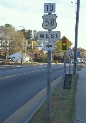
There used to be a TO US 58 cutout shield here. Now, there's only a trash can.

But to assuage your grief, there's an RC Cola machine just across the street. Actually, there are two, this one, and another one at a flea market down the street.

Back southbound on 258 Business, exiting the City of Franklin and going back to Southampton County.

And back on US 258 ("Truck").

Older, all-text distance sign.

SR 684 again. In the background, you can just make out its reassurance shield.

SR 688, now with sixty percent less blur.

Virginia safety inspection sticker disapproves of taking SR 690, so we don't.


We go back onto VA 189.

Somewhere in this photo is a historical marker.

This drawbridge warning sign somewhat invalidates my earlier argument.

SR 714 ends just before the bridge.

VA 189 reassurance marker.

The drawbridge again. We reenter the City of Suffolk, even though there's not much city to be had out here.

We take VA 272 eastbound. VA 272 is also South Quay Road, as is US 58 during its VA 189 concurrency.

Photography-unfriendly pavement.

An old alignment of either VA 272 or US 58 at the former's eastern terminus.

Back onto US 58. Still more to come. Stay tuned!
No comments:
Post a Comment