
We'll start at the southern terminus of Interstate 464. The splotchiness in the shot is from rain.

I take US 17 south, a road I'm very familiar with. If I remember right, the Clearview "Outer Banks" greenout covers "Manteo".

After the I-64/464/VA 168 interchange, US 17 encounters VA 190, Great Bridge Boulevard.

After VA 190, US 17 sheds its extra lanes and becomes Dominion Boulevard, a two-lane arterial.

Next up is the southern terminus of VA 166, Bainbridge Boulevard.

The Steel Bridge carries US 17 over the southern branch of the Elizabeth River. It was opened in 1962. Its City of Chesapeake website mentions forthcoming improvements that are currently underway.
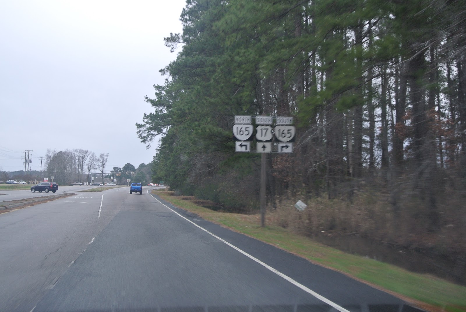
US 17 encounters VA 165, which is called Cedar Road this far out.

On VA 165 north.

VA 165 spends a little bit of time in a wrong-way concurrency with VA 168 Business.

It's only about one-half mile long.

VA 165 is now Mount Pleasant Road.

Approaching the interchange with the Chesapeake Expressway, the VA 168 mainline. Surely, there's a better way to sign this.


The VA 168 interchange.

VA 165 sheds its two extra lanes again.

Centerville Turnpike.

VA 165 passes through a swamp as it passes by NALF Fentress. Don't break down, don't get pulled over.

Drawbridge over the Chesapeake and Albemarle Canal and the North Landing River. Also, entering Virginia Beach city limits.

VA 165 veers north toward I-64, and VA 149 and Princess Anne Road take over from here. A lot of the following has been covered here and here, so I'll skip over most of the photos I took from this particular drive to save space and your eyes from poor photography skills.

Remember these?

Even though it hasn't existed for decades, the City of Virginia Beach still posts signs for SR 615, and even posts it as a primary route. It would be nice if it were all true.

It's here where I deviate from the path of the previous posts. Instead of keeping right to stay on NC 615 south, I turn left onto Knotts Island Road.


The non-state-highway portion of Knotts Island Road is very narrow.


Then it gets even more narrow. Welcome back to Virginia Beach, Virginia.

Knotts Island Road comes to an end at a cul-de-sac, with this somewhat dirty (or beaten-up) sign heralding the end.

And immediately after taking that photo, my camera died, so these last few photos were taken with my phone.

Heading back.

The state line. There's no mention you've entered Virginia except the end of the double yellow line. The short wooden post to the left of the state line sign is a latitude marker.

Back in Currituck County, North Carolina.

And back to NC 615 northbound to close the trip. Hope you enjoyed it, more trips and better photos to come in 2013.